Antarctica · antarctica
The Unclaimed Continent
How seven countries drew lines on a frozen map — and then, for once, agreed to step back.
Seven countries have drawn lines on Antarctica. None of those lines has ever been recognised. At the bottom of the world sits a landmass larger than Europe and Australia combined — and, by international agreement, it belongs to no one.
This is the story of the only continent humanity ever agreed, in writing, to share.
The Continent of Superlatives
Antarctica is the coldest, windiest, driest, emptiest, highest, and most isolated landmass on Earth. It is also the most recently discovered — the true existence of the continent has been confirmed for barely two hundred years.
The place is so dry that, in scientific classification, it is technically a desert — the largest on the planet. A typical winter night at the Russian Vostok station settles around −65 °C; in 1983, the station recorded the lowest natural air temperature ever measured on Earth: −89.2 °C.
Antarctica by the Numbers
The Last Coast Found
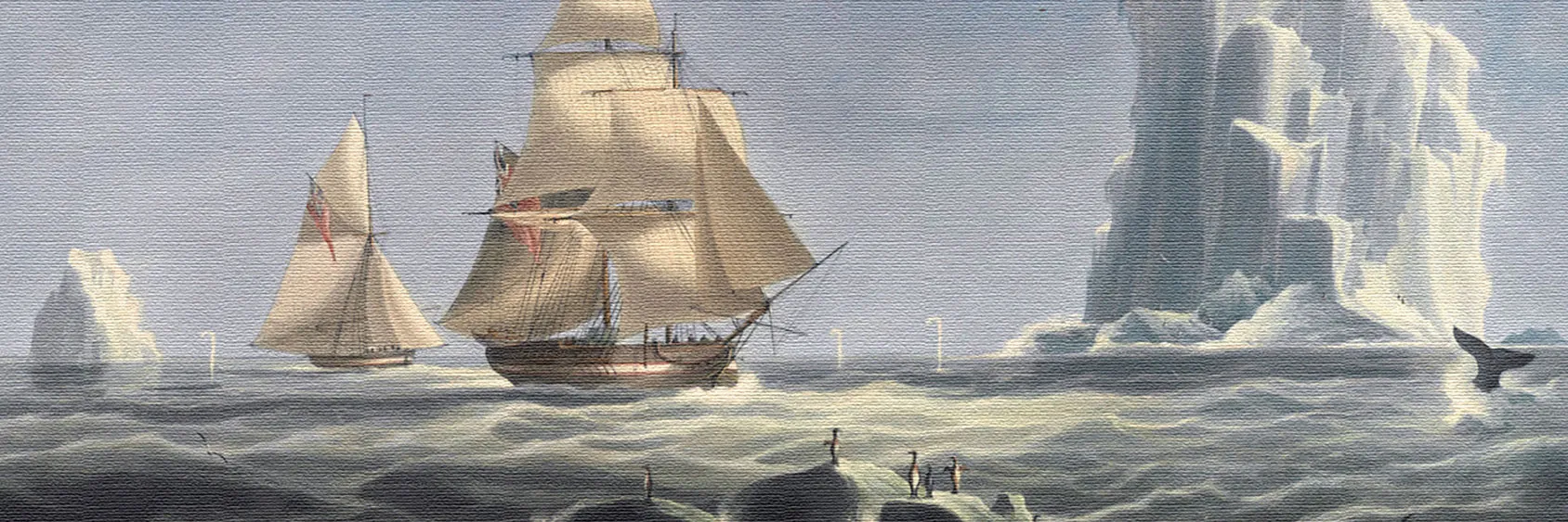
For most of the Age of Sail, Antarctica existed only as a rumour. Ancient Greek geographers had reasoned that a large landmass must balance the known continents of the north — they called the theoretical place Terra Australis Incognita, the “unknown southern land” — but no one had seen it.
In January 1773, the English navigator James Cook became the first person to sail a ship across the Antarctic Circle. For three southern summers he circumnavigated the icepack, sometimes turning back from walls of ice that reached above his mast. He never caught sight of land. The wooden hulls of the eighteenth century could not survive the pack ice long enough to break through it; Cook concluded, correctly, that a continent was there, and, pessimistically, that “no man will ever venture further than I have done.”
He was wrong by forty-seven years.
In January 1820, three sailors on three different ships — the Russian Thaddeus von Bellingshausen, the British Royal Navy officer Edward Bransfield, and an American sealing captain named Nathaniel Palmer — all sighted Antarctica within weeks of each other, without knowing the others had. Bellingshausen reported an “ice coast of extreme height.” Bransfield reported “snow-covered mountains.” Palmer reported a dark line of land beyond the bergs. Who first saw the continent is still argued in three different national histories. That it existed at last became undeniable.
The Heroic Age
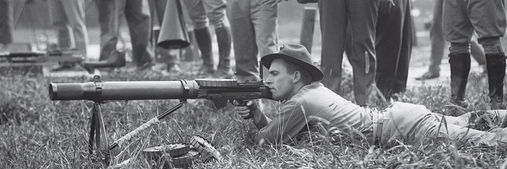
The first two decades of the twentieth century are known, in polar histories, as the heroic age of Antarctic exploration — a period of ambition, scurvy, and frostbite in which national expeditions raced to push further inland. The science was serious; the suffering was biblical.
The race for the South Pole itself came down to two men. The Norwegian Roald Amundsen, travelling light and using Greenland dogs, reached the pole on 14 December 1911. The Briton Robert Falcon Scott — using motorised sledges that broke down, ponies that froze, and men dragging sledges themselves — reached the pole thirty-four days later, and died with his entire party on the return journey. Scott’s last diary entry, written in a collapsed tent eleven miles short of the next food depot, is one of the most famous lines of Edwardian literature. The continent had begun to accumulate its mythology.
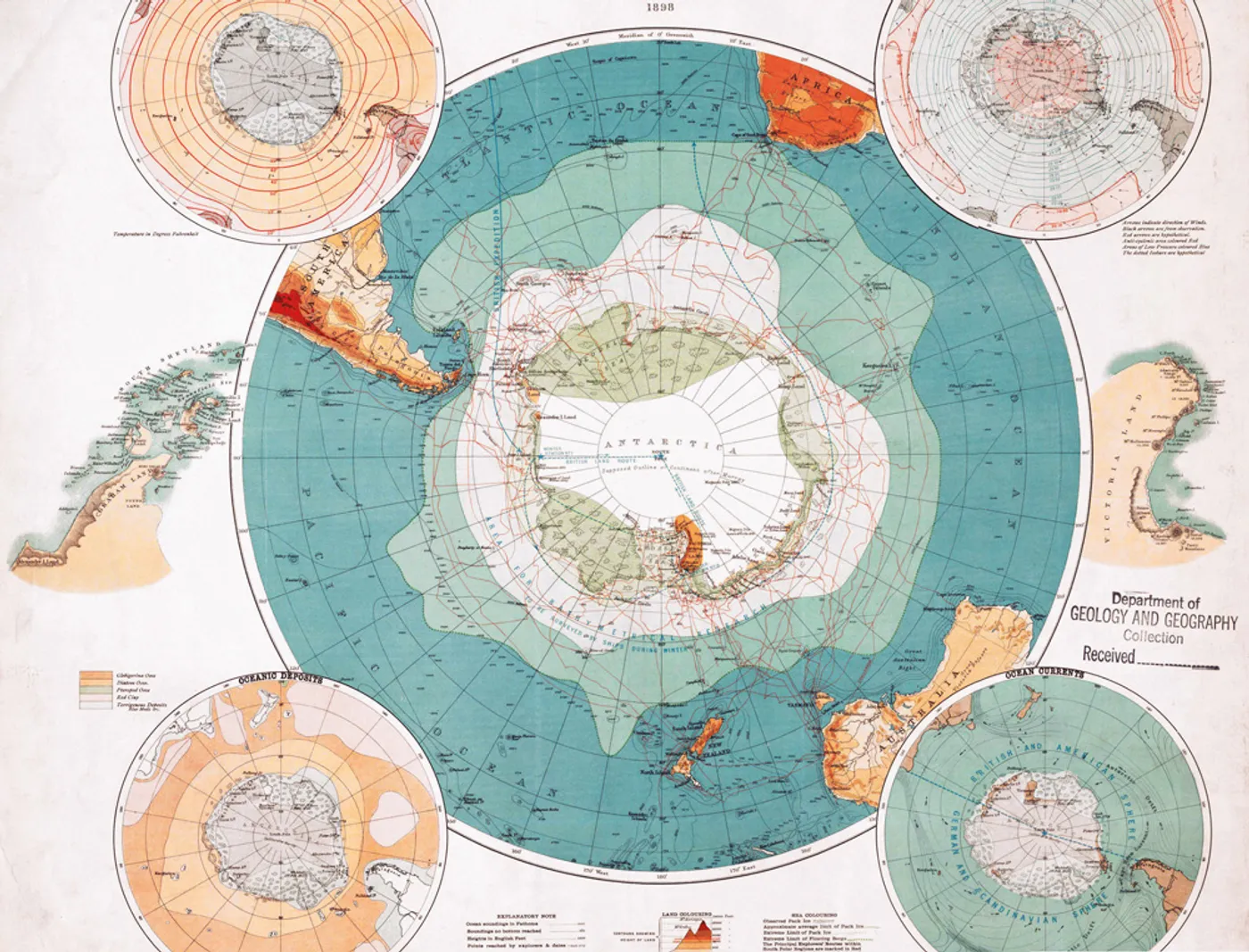
Seven Slices of a Cake Nobody Could Eat
By the 1930s, the heroism had given way to diplomacy — and to a more familiar pattern. Countries with polar expeditions began drawing lines on the map of a continent almost none of their citizens would ever see.
Between 1908 and 1942, seven nations declared sovereignty over pie-slice sectors of Antarctica: Britain (1908), New Zealand (1923), France (1924), Australia (1933), Norway (1939), Chile (1940), and Argentina (1942). Some of these claims overlapped each other badly — three different countries claimed the Antarctic Peninsula, the continent’s finger pointing toward South America — and each claimant wrote its ownership into law as if the continent were an already-conquered colony.
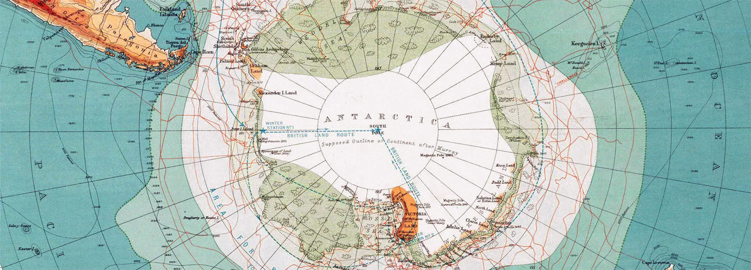
By the 1950s, thirty countries had some form of presence on the continent — scientific stations, weather outposts, commercial interests, or strategic ambitions. The United States and the Soviet Union, neither of them claimants, were becoming visibly uneasy. The International Geophysical Year of 1957–58 saw twelve nations cooperating on Antarctic research; the political question of who owned the continent was, by then, plainly in the way of the science.
The Treaty That Froze Everything
On 15 October 1959, twelve delegations met in Washington. Six weeks of negotiations later, on 1 December 1959, they signed the Antarctic Treaty.
The signatories were the seven claimant states — Britain, New Zealand, France, Australia, Norway, Chile, Argentina — and five other countries with active programmes on the ice: Belgium, Japan, South Africa, the Soviet Union, and the United States. The treaty entered into force on 23 June 1961.
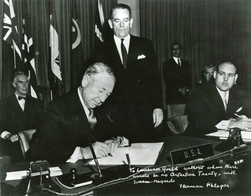
The document achieved something remarkable for the middle of the Cold War: it took a continent that every signatory wanted and agreed, as a collective, that no one would push the question. Its central promises read like a peace treaty rewritten as an operating manual.
- Antarctica would be used exclusively for peaceful purposes. No military bases. No weapons tests. No bombs.
- Freedom of scientific investigation. Any signatory could conduct research anywhere on the continent, and the results would be shared.
- Territorial claims frozen in place. Existing claims were neither confirmed nor rejected; no new claims could be made.
- Inspections by any party, at any time. Bases had to be open to visits from inspectors of any other signatory.
Territorial sovereignty — the heart of the modern nation-state — was quietly set aside for an entire continent. Fifty-six countries have now signed on. The continent has, as of today, no government, no flag, no currency, and no permanent population — only rotating scientific residents living in more than a hundred research stations, from Argentina’s Esperanza on the peninsula to the Japanese Showa Station in East Antarctica.
The Ice Beneath the Ice
In 1998, the Madrid Protocol (formally the Protocol on Environmental Protection to the Antarctic Treaty) came into force, extending the original treaty’s spirit in one important direction: it banned all mining and mineral extraction on the continent for fifty years, and formally designated Antarctica “a natural reserve, devoted to peace and science.”
Fifty years is, in diplomatic time, a deliberate deadline. The Madrid Protocol’s mining ban becomes reviewable in 2048. No one can say yet what happens then. The continent sits on significant coal, iron, and hydrocarbon reserves, and climate change is slowly pushing the ice back from coastlines that were previously unreachable. A treaty negotiated in 1959 by twelve countries is now governed by fifty-six, and any one of them can ask, at the 2048 review, for the question of resources to be reopened.
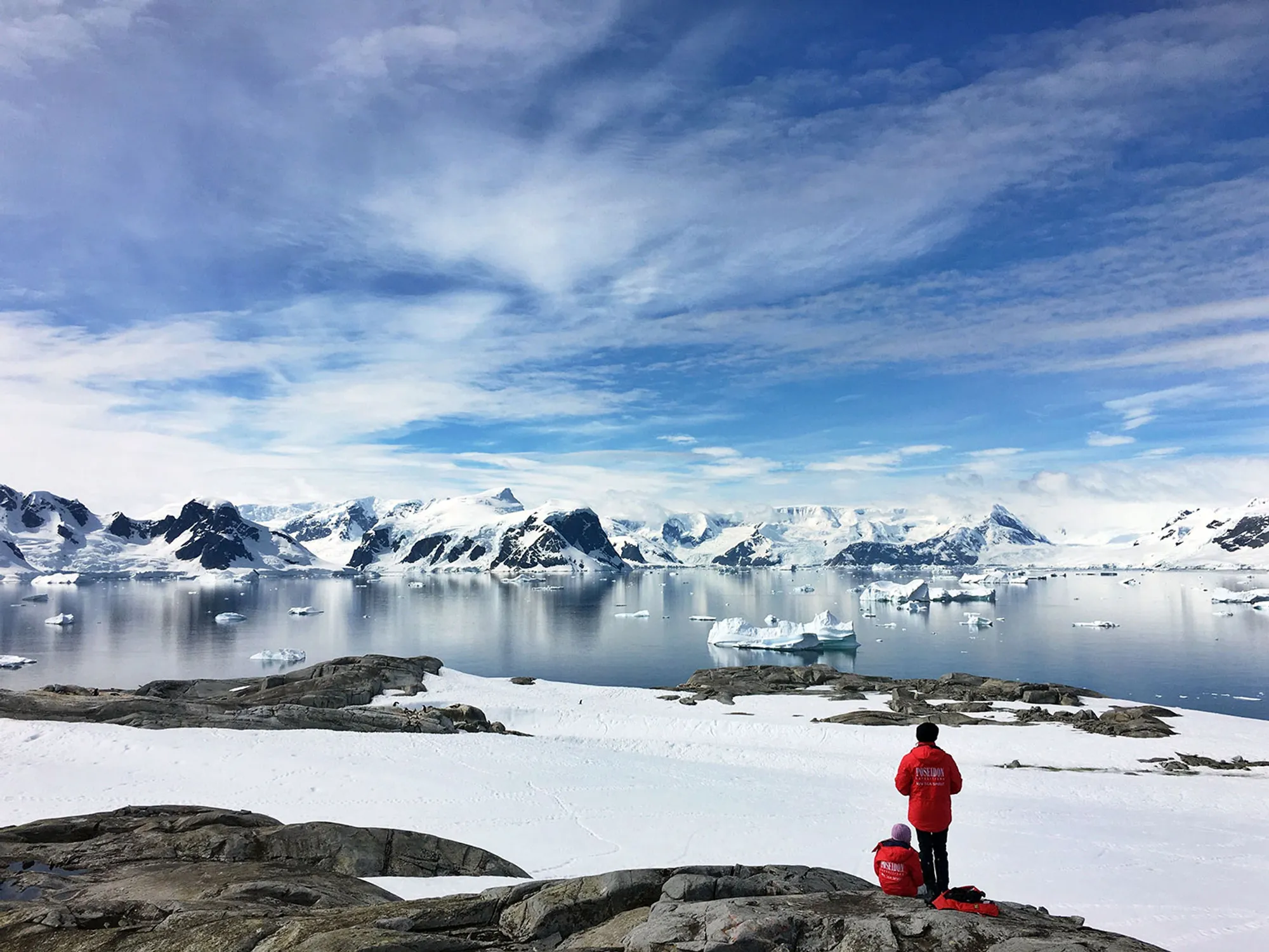
A Modern Way to Visit
No visa is required to enter Antarctica. There is no country to issue one. The continent is reached almost entirely via tourist ships and charter flights from Ushuaia in Argentina or Christchurch in New Zealand, and only during the southern summer, when the ice shelves retreat enough for passage.
Roughly 45,000 tourists now visit each year. Most never leave the northern tip of the peninsula. Those who do spend a few hours standing on pack ice that is older than the countries their passports came from.
There is a specific, unfashionable kind of optimism to what happened in Washington in 1959. In a decade otherwise defined by proxy wars and nuclear brinksmanship, twelve governments — half of them at each other’s throats elsewhere — signed a document saying, in effect: this one place, we will leave alone. Six decades on, the ice has not melted the agreement. It has, if anything, quietly proven that such agreements are possible.
The fragile part is no longer the treaty. It is the ice.
Sources
- Mahmut Oğuz Selbesoğlu, Mehmet İşiler, Tolga Bakırman, and Şehriban Yiğit, Renewable Energy Potential in the Context of Existing Research Stations in Antarctica and a Preliminary Study on the Turkish Research Base.
- Antarctica, Encyclopædia Britannica — britannica.com/place/Antarctica.
- Antarctic Explorers, Royal Museums Greenwich — rmg.co.uk/stories/topics/history-antarctic-explorers.
Adapted from “Sahipsiz Kıta Antarktika” by Tuna Ser, originally published in Yedikıta Dergisi issue 187, March 2024. Statistical and meteorological figures cross-checked against publicly available records maintained by the British Antarctic Survey and the Scientific Committee on Antarctic Research.